
VNS That Frees UAVs from EWs
- Muhammed Said Bilal Dolar

- Apr 24, 2025
- 3 min read
Updated: Apr 27, 2025
Why GNSS Isn’t Enough
Most of us know GNSS(Global Navigation Satellite System) technology as GPS(Global Positioning System), which was developed by the US. On the other hand, GNSS is the name given to systems like GPS(US), Galileo(EU), GLONASS(Russia), and BeiDou(China).

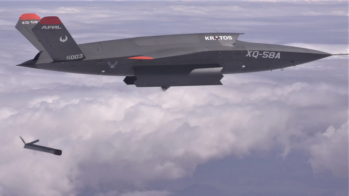
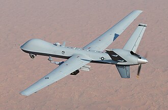
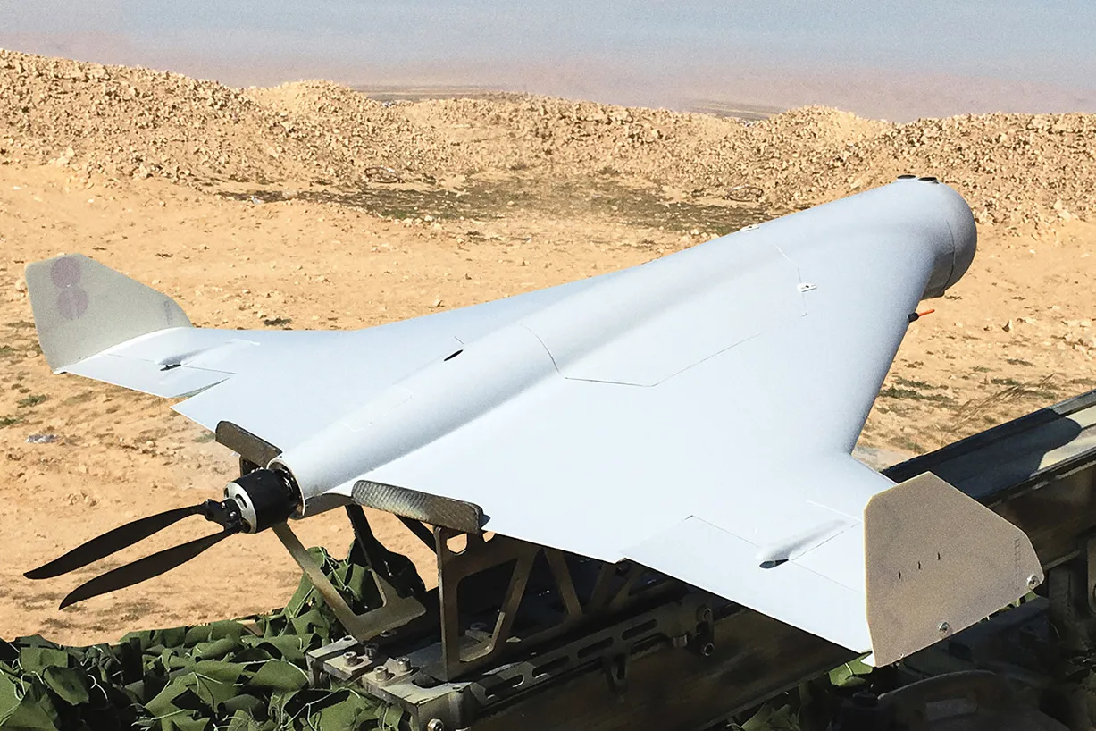
As a result of the geopolitical situation in the world right now, we have encountered big regional conflicts. In these conflicts, as a result of development in production technology, materials science, and electronics, we are able to see a lot of UAV(Unmanned Aerial Vehicle) applications in these conflicts. These UAV systems bring with them cutting-edge technologies that help with reconnaissance, kamikaze, strike, and humanitarian missions. UAVs have the advantage over conventional systems like usual manned aircrafts and manually controlled Anti-Tank munitions. Being unmanned brings the main vulnerability: dependence on a ground control station. If you lose communication with the UAV systems, you lose control over the aircraft and the aircraft itself, so this causes danger on the battlefield, financial loss, and mission failure. Engineers and Military strategists approach this vulnerability by using EW(Electronic warfare) and Spoofing systems.


Electronic Warfare is a technology based on blocking communications by sending powerful enough signals at the same frequency as the ground station control communications with a directional antenna to the object and isolating it from ground station control communications.


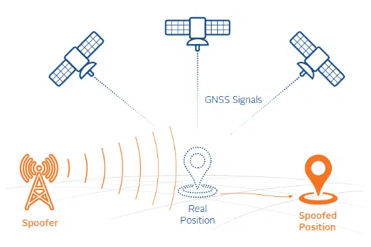
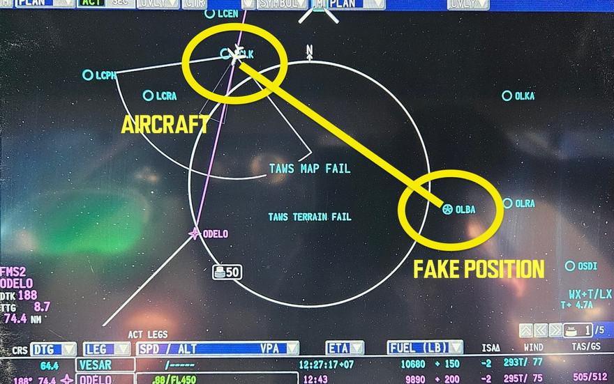
Also, another countermeasure used against aircraft is spoofing. Strong signals emitted at the same wavelength confuse the GNSS module onboard the aircraft after spoofing a new set of coordinates transferred to the flight system. Spoofing usually occurs in war, or it can happen anywhere, like it did near Iran in 2023.


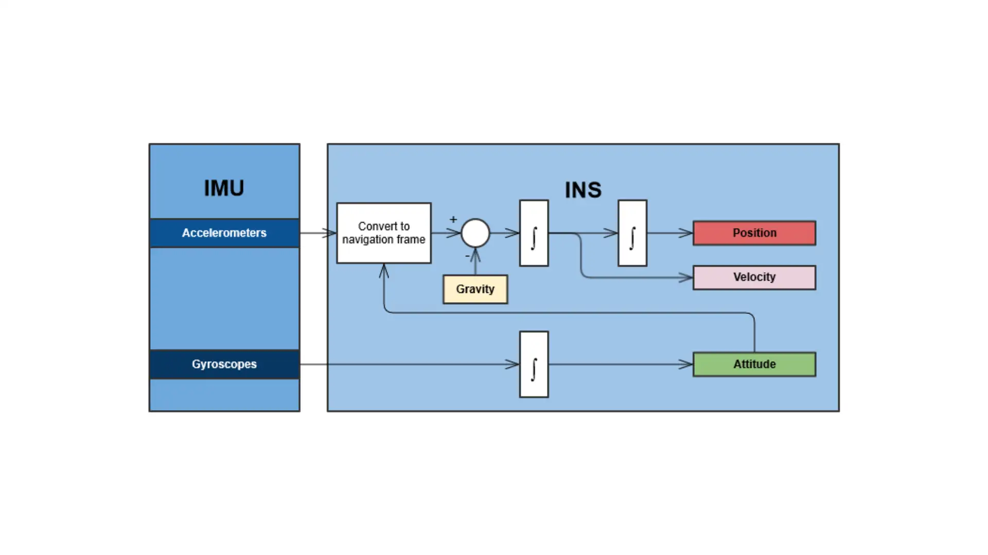
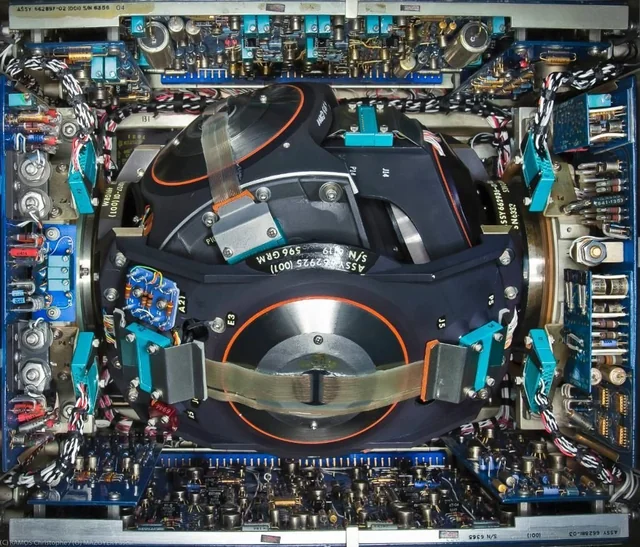
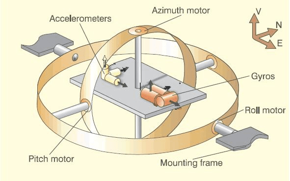
Besides GNSS navigation systems, aircraft can rely on INS(Inertial Navigation System). INS relies on onboard systems, and as a result of this, it contains complex hardware with high manufacturing costs to increase accuracy. On the other hand, GNSS relies totally on a complex satellite network, decreasing the price of aircraft onboard hardware. For example, almost everyone has GPS services on their smartphones instead of onboard INS systems. INS systems consist of computers combined with IMU(Inertial Measurement Unit), while IMUs, on the other hand, consist of accelerometers, gyroscopes, and magnetometers, increasing the cost per unit compared to GNSS navigation systems.
How Visual Navigation Works
EW, Spoofing, and the expense of INS are one of the main reasons that led to the development of VNS(Visual Navigation System). VNS focuses on real-time data flow from an onboard camera looking down and capturing real-time images of the ground. These images by special algorithms, are compared to map data divided into tiles and uploaded beforehand to the plane. After comparison, the onboard computer knows the approximate location of the drone and transmits the GPS coordinates using the same protocol as GNSS systems to the flight computer. The flight computer, after getting data, follows the route or mission plan uploaded before the launch. The algorithm that compares images is a deep learning algorithm.
Below, you can see how the system works.
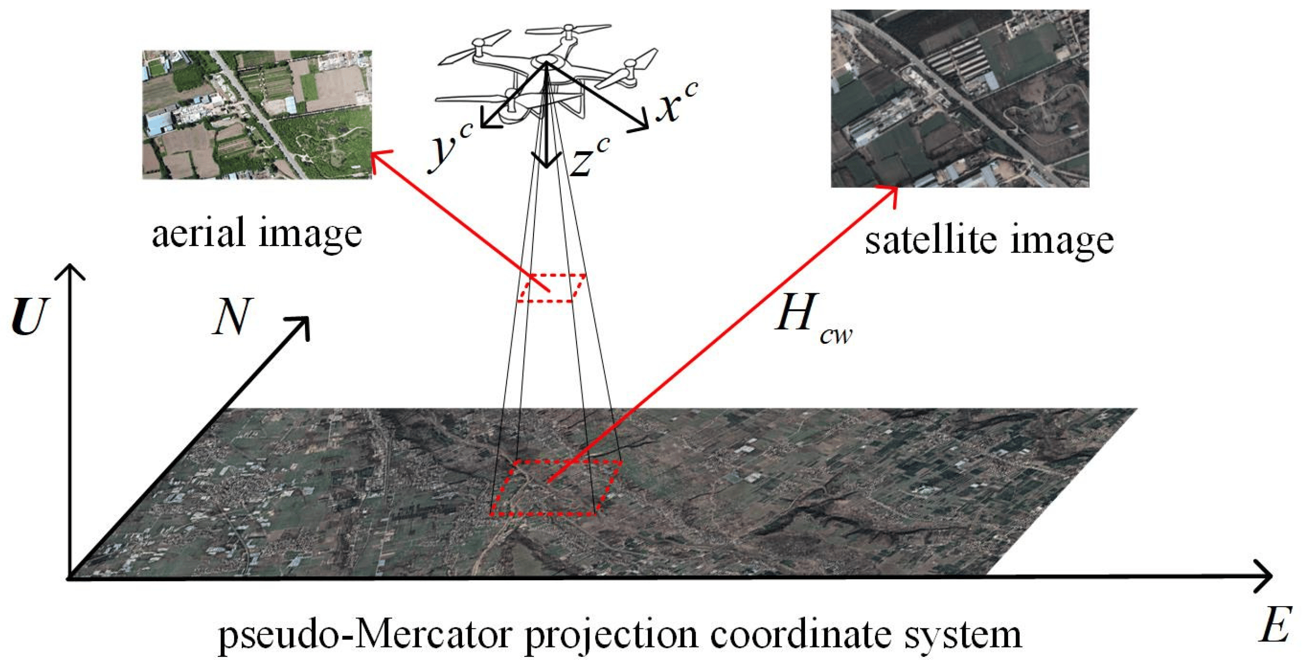


As the VNS system doesn't have downlink or uplink communication, it is not possible to jam by regular EW or Spoofing systems. Also, VNS consists of just one camera module and a small computer, making this type of navigation system affordable.


Current Applications


VNS gained popularity by advancements in technology, software, availability of ML(Machine Learning) algorithms, and an increased number of EW applications in conflicts. Currently, startups like Theseus are working with the USAF on integrating this technology into military applications.
My personal point of view is that this technology can potentially replace GNSS for particular applications in the military industry due to increased EW and Spoofing usage. By integrating a cheap INS system( or just connecting the IMU to the VNS computer), we can increase the accuracy of the VNS system.


Comments